Nova totius Graeciae by Jacob Sandrart
Download
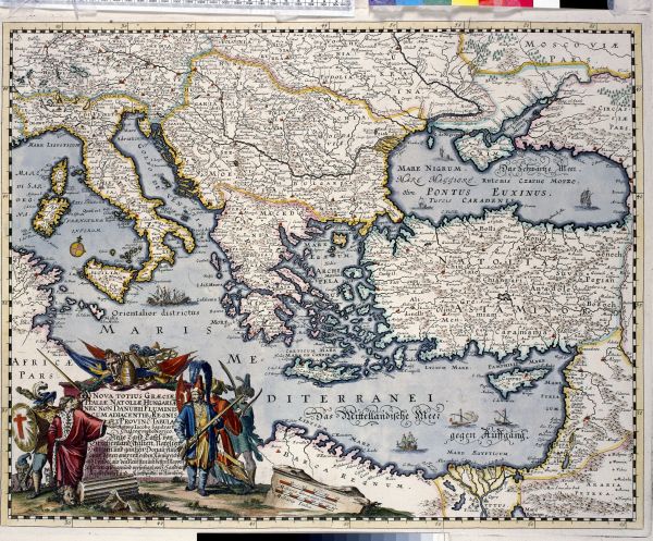
Nova totius Graeciae, Italiae, Natoliae, Hungariae nec non Danubii fluminis ... (New map of of Greece, Italy, Anatolia, Hungary and the Danube River ...)
Nuremberg: Jacob Sandrart, c. 1660
hand-coloured engraving
41.1 × 52.5 (image)
42.3 × 54.1 (plate)
52.7 × 62.1 (sheet)
Ronald and Pamela Walker Collection, gift of Ronald and Pamela Walker, 1991
Map Collection
University of Melbourne Library
http://hdl.handle.net/11343/23745
Map Collection, University of Melbourne Library
This map of the eastern Mediterranean helps us locate sites where notable events occurred in ancient times, and where artefacts from those regions originated. It also covers the Ottoman territories in Europe, Anatolia, the Middle East and north Africa. In the 17th century, the Ottoman Empire was at the height of its power; the large and elaborate cartouche (lower left) depicting Turkish and European soldiers refers to conflicts of the day.
Engraved maps such as this were printed in black ink only and later coloured by hand, often to suit the requirements of a particular publisher or patron. For this reason the colouring may be different on each map.
Jacob Sandrart was a prolific engraver of maps and illustrations. He drew many of the images for the art-history textbook Teutsche Academie, working for its author, Joachim Sandrart (1606–1688), who was both his uncle and teacher.
Teaching ideas
The University of Melbourne’s curriculum is rich and varied, and changes from year to year. For more teaching ideas, contact a collection manager.
Mapping Environments
Visit the Map Collection and view regional maps such as those depicting the Mediterranean. What is their role in comparison to charts, projections and world maps?
Morphological Mapping
Visit the Map Collection and view historical maps, such as regional maps. Do they contain layers of urban data that may be useful for creating morphological maps?
Interpreting the Ancient World
Critically analyse Sandrart’s map of the eastern Mediterranean. How does it reveal social contexts of the ancient past?
Ancient Greece: History and Archaeology
Identify some of the political, socio-economic and cultural changes in Greek civilisation, and how these are shown in maps of the Mediterranean.
Myth, Art and Empire: Greece and Rome
View maps in the Map Collection and explain how heroic archetypes, gods and goddesses influenced the designs of historical maps, both through the landmasses depicted and the decorations added.
Age of Empires
Explain how the experience of the Ottoman Empire may have affected empires of the 18th century. How were empires coloured on maps, and what was the significance of this colouring?
Historical Thinking
Select a map from the Map Collection. Explain how it may be used as a tool in historical thinking, and describe its implications for learning and teaching.
Knowledge, Learning and Culture
Visit the Map Collection and, working in groups, examine maps and discuss how they transmit knowledge.
Intersecting objects
-
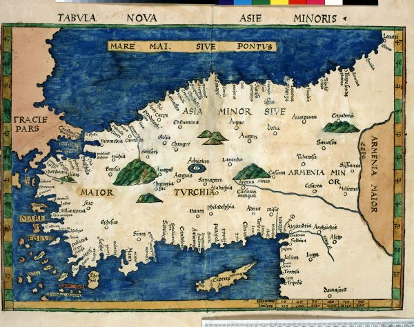
Martin Waldseemüller (German, 1470–1520)
after Claudius Ptolemy (Egyptian, c. AD 100 –170)
Tabvla nova Asie Minoris (New map of Asia Minor)
from Claudius Ptolemy, [Geographia], Strasbourg: Johann Schott, 1513
hand-coloured woodcut
34.0 × 47.0 cm (sheet)
Ronald and Pamela Walker Collection, gift of Ronald and Pamela Walker, 1991
Map Collection
University of Melbourne Library
http://hdl.handle.net/11343/23857 -
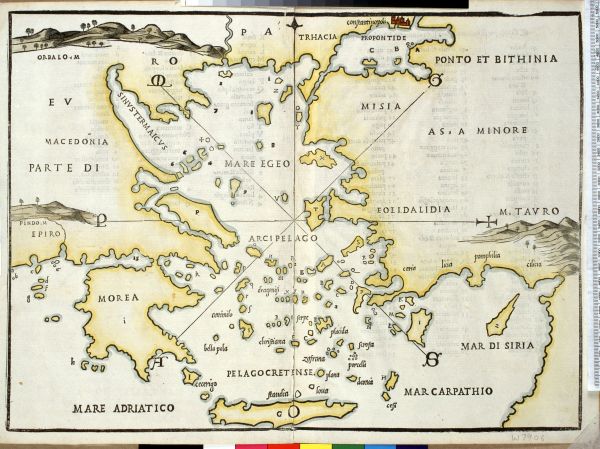
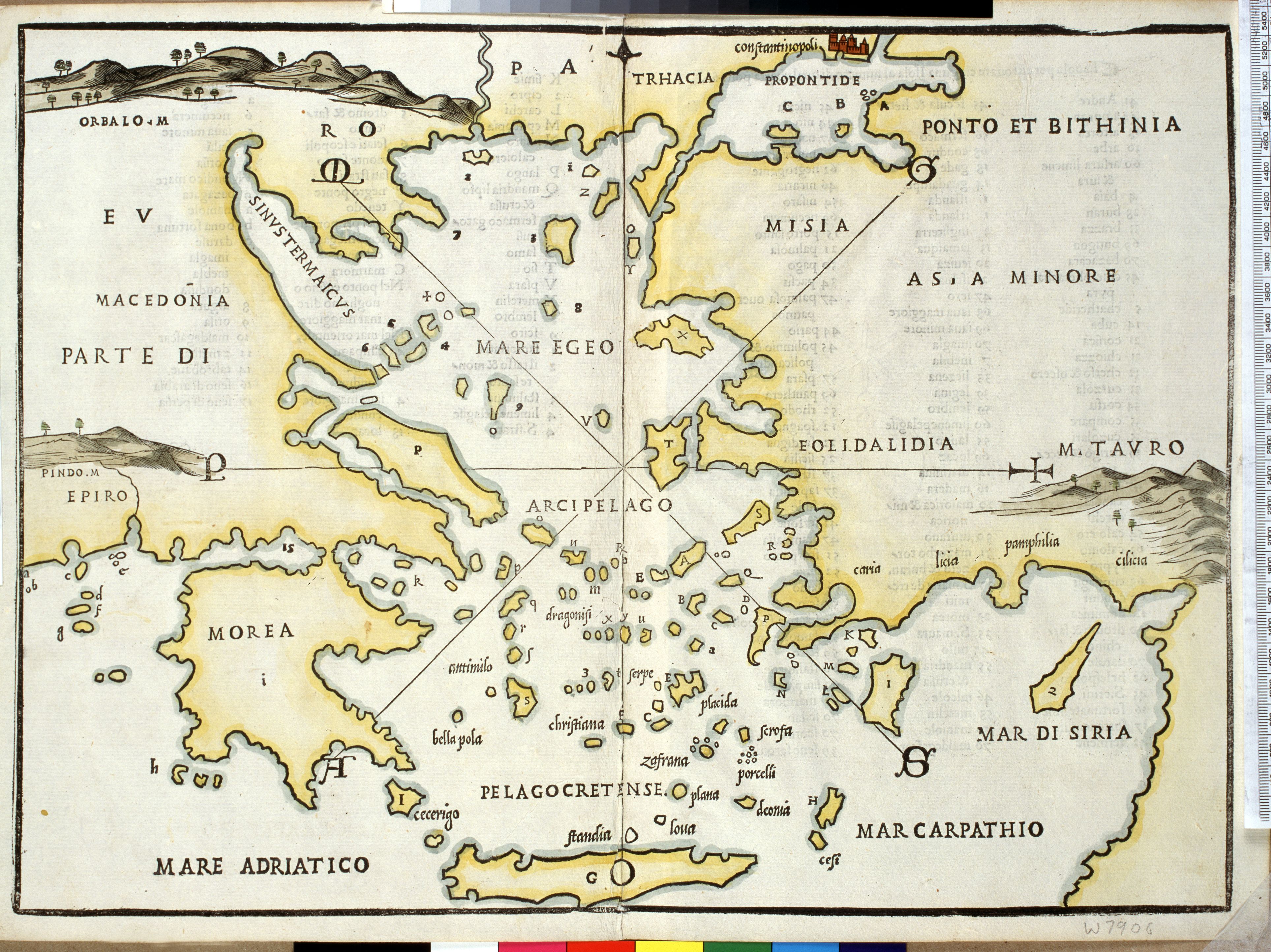
Benedetto Bordone (Italian, d. 1539)
[Greece]
from Libro di Benedetto Bordone nel qual si ragiona de tutte l’isole del mondo ...
Venice: For Nicolo d’Aristotile, known as Zoppino, 1528
hand-coloured woodcut
30.0 × 40.0 cm (sheet)
Ronald and Pamela Walker Collection, gift of Ronald and Pamela Walker, 1991
Map Collection
University of Melbourne Library
http://hdl.handle.net/11343/23781

To learn more, visit the website of the Map Collection.
Further reading
David Jones and Julianne Simpson, Peregrinations in Asia Minor: European description and cartography in the 16th and 17th centuries, University of Melbourne Library, 2005.
An exhibition of exquisite rare maps of Asia Minor, Baillieu Library, University of Melbourne, 1992.
Richard J.A. Talbert and Roger S. Bagnall (eds), Barrington atlas of the Greek and Roman world, Princeton University Press, 2000.