Collection areas
Rare Maps Collections
-
Comprising over 270 maps, this collection includes beautifully ornamented and coloured works by important figures in the development of cartography, such as Claudius Ptolemy, Abraham Ortelius and Gerhard Mercator.
The collection was formed during the 1970s and 1980s during Ronald Walker’s time as a diplomat in Turkey. Created within the thematic context of ‘Printed maps of Turkey before 1700 AD’, the collection traces the evolution of European map making from the late 15th century to the end of the 18th century. It includes maps of Asia Minor and nearby areas such as the Mediterranean, Middle East and the Balkans, and in particular Constantinople.
-
The historical collection of British Admiralty charts covers all regions where Commonwealth ships navigated. Relief is shown by contours, and spot heights; depth is shown by bathymetric tints and soundings. These charts are highly useful for the study of coastlines.
-
This collection contains materials dating from original, very early aerial photography of Victoria, up to the latest geospatial aerial digital material. For more information please refer to our Aerial Photography Resources.
-
MMBW were founded in 1891, charged with installing adequate water supply, sewerage and sewage treatment functions for Melbourne. This process required the creation of very accurate maps surveying the city including all roads, buildings and infrastructure. This collection contains many of these surveys.
-
As well as the very earliest mapping of Melbourne, the Rare Maps Collection holds a range of historical street directories, including maps of the Sands & McDougall Street Directory (1868-1899) the Melways Directories (1966-1999) (available under license) plus other named directories of Melbourne and Australian capital cities.
-
Gazetteer geographical directories list official names of locations and features with latitude and longitude coordinates. These books provide a dated snapshot of cities, towns, villages, rivers, lakes and other significant locations. These can be useful in tracing the changes of place names or exact location names that are no longer in use.
-
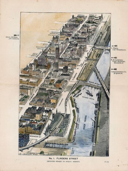
Prepared for insurance companies, so they could gauge fire risks, these two original bound books of Melbourne CBD building plans are extremely detailed and list occupants, construction materials, and fire protection facilities.
-
The Great Trigonometrical Survey was undertaken by the East India Company in 1802 with the goal of producing a precise scientific survey of the subcontinent; it was completed only in 1871. The Rare Maps Collection hold a selection of these materials, along with a number of contemporary map series of India dating from after 1950, including maps at a 1 inch: 1 mile ratio.
General Maps Collection
One of the largest repositories of maps and related materials in Australia, our General collection holds more than 120,000 printed maps; 10,000 general text and thematic atlases; 15,000 aerial photographs; Geographic Information System (GIS) datasets and digital maps; and a broad range of reference works. Its contents span the world and its major cities, with a particular focus on:
Australia – including large scale cadastral plans; aerial photographs; administrative boundaries, subdivision plans and goldfield maps; geological and soil maps, conservation and planning studies; CSIRO studies; topographic maps; and specialised thematic maps.
International – comprehensive topographic maps of the world, along with thematic materials including
political boundaries; vegetation types; geology and soils; language groups; energy and resources.
Particular strengths include Asia, the Middle East, the British Isles and the Pacific region.