Polus Antarcticus by Jan Jansson
Download
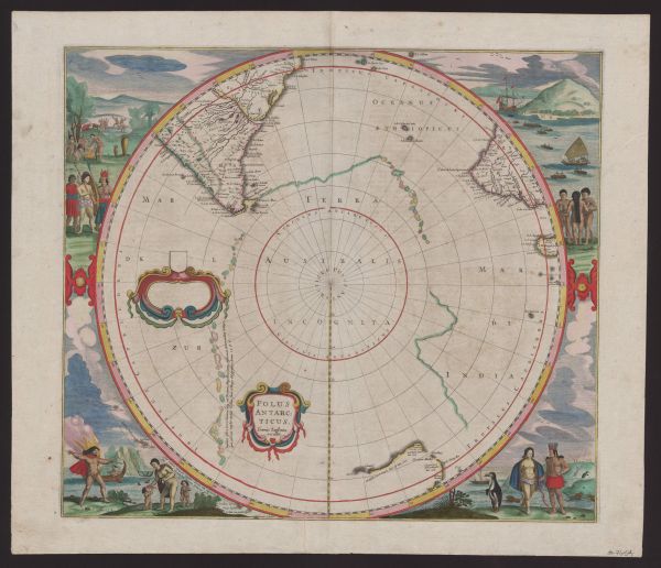
after Henricus Hondius (Dutch, 1597–1651)
Polus Antarcticus (South Pole)
Amsterdam: Jan Jansson, c. 1641–50
hand-coloured engraving
43.2 cm (diameter)
43.2 × 49.2 cm (sheet)
Purchased 2014
Map Collection
University of Melbourne Library
http://hdl.handle.net/11343/113796
Map Collection, University of Melbourne Library
Polus Antarcticus was first issued in 1637 by Dutch cartographer and engraver Henricus Hondius. The map proved to be so innovative and appealing that it was revised and reprinted over a period of more than 60 years by several publishers, including Jan Jansson.
The map shows the then largely unexplored southern polar region. It includes southern parts of South America and South Africa, the west and south coasts of Australia, much of which was charted by the Dutch in the 17th century.
Aesthetics became important for commercially produced maps such as Polus Antarcticus. For this reason the sheet is bordered with attractive hand-coloured depictions of exotic people and animals as perceived by Europeans. Native Americans preparing a meal over a fire (top left) were a pictorial trope, but the scene at lower right offers new sights: penguins and, in the water behind, ‘sea lions’, literally rendered.
The circular projection is unconventional and arresting. This was probably the first map to provide information about the Arctic landmass, which would not be formally explored and mapped until the 19th century.
Teaching ideas
The University of Melbourne’s curriculum is rich and varied, and changes from year to year. For more teaching ideas, contact a collection manager.
Mapping Environments
Polus Antarcticus is a circular projection. How is this achieved? Visit the Map Collection to view other examples of historical maps, and compare a variety of examples at first hand.
Imaging the Environment
Describe the characteristics of different landmass-imaging techniques used in historical maps. Consider the role of decoration and colour, and the commercial imperatives of map production.
The Nature of Reality
Discuss Polus Antarcticus or another map from the Map Collection in relation to realism and idealism. What aspects of our mind do we use to interpret the map? What aspects of time does the map convey?
A History of Nature
Select a map from the Map Collection and compare the border decoration to the landmass depicted. What does each say about nature? Are they conveying the same ideas about nature?
Migration and Development
In maps at the university, what evidence can you find of circumstances that can lead to human mobility?
Applied Geophysics
The use of a circular projection in Polus Antarcticus was rather radical; use it as a basis for creating a map projection of your own devising.
First 1000 Days in Indigenous Contexts
How did the first 1000 days of contact between Europeans and Indigenous communities across Australia, Indonesia and the Arctic Circle differ from the 17th century to the 21st century? In your answer, discuss the representations of Indigenous people in Polus Antarcticus.
Knowledge, Learning and Culture
Visit the Map Collection and, working in groups, examine maps and discuss how they transmit knowledge.
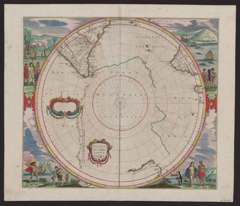
Intersecting objects
-
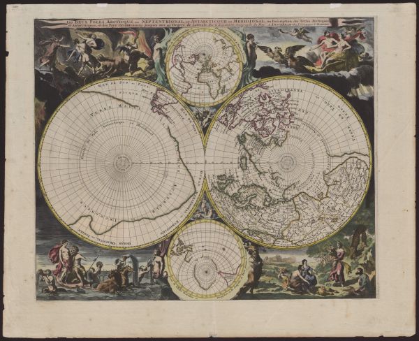
Nicolas Sanson (French, 1600–1667)
Les deux poles Arcticque ou septentrional, et Antarcticque ou meridional, ou description des terres Arcticques et Antarcticques (The two poles, northern or Arctic, and southern or Antarctic, or description of Arctic and Antarctic lands)
from Nieuwe atlas, inhoudende de vier gedeeltens der waereld
Amsterdam: Covens and Mortier, c. 1690
hand-coloured engraving
26.0 cm (diameter of each large hemisphere)
51.0 × 63.0 cm (sheet)
Purchased 2014
Map Collection
University of Melbourne Library
http://hdl.handle.net/11343/113772 -
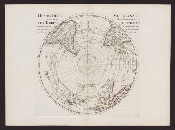
Guillaume de l’Isle (French, 1675–1726)
Hemisphere meridional pour voir plus distinctement les terres Australes (Meridional hemisphere for a more distinct view of the southern lands)
Paris: Guillaume de l’Isle, 1714
hand-coloured engraving
43.7 cm (diameter)
52.4 × 59.9 cm (sheet)
Purchased 2014
Map Collection
University of Melbourne Library
http://hdl.handle.net/11343/113760

To learn more, visit the website of the Map Collection.
Further reading
University of Melbourne Library, Plotting the island: Dreams, discovery and disaster (forthcoming, 2017).
National Library of Australia, Mapping our world: Terra Incognita to Australia, Canberra: National Library of Australia, 2013.
University of Melbourne Library, The Pacific in maps: An exhibition from the Map Section, University of Melbourne Library, 1996.